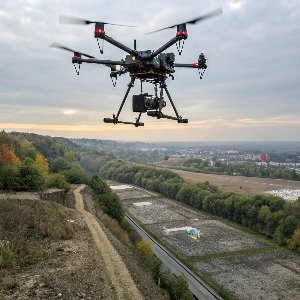
Drone inspection solution
Powered by drones, drone hubs, and fully automated UAV systems, our solution enables scheduled, unmanned inspections through intelligent software, with AI-driven real-time defect analysis—significantly enhancing operational efficiency and safety across industries.
Process of Customized Inspection Solutions
EFLY AVIATION’s Standard Process for Customized Drone Inspection Solutions
Combining technical expertise and industry experience to ensure scientific and practical solutions.
1. InDepth Pain Point Analysis
- Site survey (terrain/climate/electromagnetic environment scanning)
- Client workflow analysis (e.g., boltlevel defect detection on power towers, precision requirements for PV panel hotspot checks)
- Regulatory compliance review (airspace permits/data security)
2. Technical Adaptation Design
- Hardware Selection: Choose drone hub type (fixed/mobile/PVspecific).
- Software Configuration: Match AI algorithms (e.g., power line corridor vegetation analysis vs. wind turbine blade crack detection)
- Communication Setup: Hybrid 4G/5G/satellite networking
3. Digital Twin Simulation
Conducted on EFLY SmartInspector® platform:
- Flight path simulation (autoavoid nofly zones/obstacles)
- Mission time estimation (battery life/replacement optimization)
- Defect detection accuracy verification (trained on historical data)
4. OnSite Stress Testing
- Extreme environment tests (30°C cold/salt fog/Level 7 winds)
- 72hour unmanned operation test
- Generate System Robustness Report (with MTBF ≥10,000 hours certification)
5. Personnel Training System
- Custom training (theory + AR simulations)
- Issue EFLYcertified operator licenses
- Provide localized SOP manuals (including emergency protocols)
6. Data Value Loop
- Autogenerate multidimensional reports (equipment health scores/risk predictions/maintenance recommendations)
- Integrate with client management systems (e.g., power grid PMS 2.0/oilgas pipeline GIS)
- Monthly OTA updates for algorithm models
7. Full Lifecycle Management
- Deploy EFLY EagleEye® remote monitoring platform
- Annual system health diagnostics
- Free upgrades to latestgeneration drone hubs
Key Components
| Component | Description |
|---|---|
| Solar-Powered Drawer-Type Drone Hub | Powered by solar energy with built-in storage, the hub supports fast installation and versatile deployment. It enables full automation—charging, environmental monitoring, and real-time data transmission, etc. —within a 5 km inspection radius. |
| Drone | Compatible with various DJI and Autel drone models, the hub allows flexible integration without the need for custom UAVs. |
| Multi-Sensor System | Thermal imaging, LiDAR, HD cameras, multispectral sensors. |
| Flight Control System | Autonomous navigation, obstacle avoidance, precise pathing. |
| AI Recognition | Automatic defect detection, vegetation and corrosion analysis. |
| Data Management Platform | Cloud-based analysis, reporting, and maintenance tracking |
Drone Inspection industry applications
Drone inspection is transforming multiple industries by offering efficient, safe, and cost-effective monitoring solutions.
In the oil and gas sector, drones are used to inspect pipelines and detect leaks over long distances. In agriculture and forestry, they enable crop health analysis, forest monitoring, and land surveying. Urban management departments deploy drones for infrastructure inspection, traffic monitoring, and environmental assessments. In firefighting and emergency response, drones provide real-time aerial views to support rapid decision-making and improve rescue efficiency.
Across all these sectors, drones help reduce risks, lower costs, and deliver high-precision data with minimal disruption.
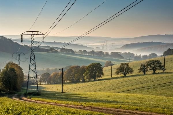
Power Inspection
Conduct efficient inspections of power lines, substations, and renewable sites with high-resolution drone imaging.
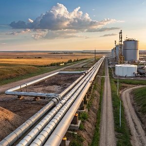
Oil & Gas Pipeline Monitoring
Monitor pipelines and critical assets across vast terrains with autonomous drone flights.
Surveying & Mapping Service
Capture accurate aerial data for planning, construction, and land development projects.
Infrastructure & Transport
Inspect roads, bridges, and tunnels with drones to detect damage and plan maintenance.

Environmental Monitoring
Track air quality, vegetation, and habitat changes using advanced drone sensors.

Customer Benefits
-
1. Enhanced Efficiency and Speed
Rapid coverage of large or complex areas compared to manual inspections.
-
2. Access to Hazardous or Inaccessible Areas
Safely inspect high-voltage power lines, offshore platforms, or disaster zones.
-
3. Cost-Effectiveness
Reduce labor, equipment, and downtime costs.
-
4. High-Quality Data Collection
Capture high-resolution imagery, thermal data, LiDAR, and multispectral sensor data.
-
5. Zero or Minimized Operational Disruption
Conduct inspections without shutting down facilities or infrastructure.
-
6. Real-Time Monitoring and Analysis
Stream live data for immediate decision-making.
-
7. Improved Safety
Eliminate risks to human inspectors in dangerous environments.
-
8. Scalability
Adapt to projects of any size, from small sites to sprawling industrial complexes.
-
9. Environmental Sustainability
Lower carbon footprint compared to traditional inspection vehicles.
-
10. Predictive Maintenance Insights
Leverage AI-powered analytics to identify issues before failures occur.